Sunway Logo

Your Cookie & Data Settings

We use cookies to help you navigate efficiently and perform certain functions.

The cookies that are categorized as "Necessary" are stored on your browser as they are essential for enabling the basic functionalities of the site.

We also use third-party cookies that help us analyze how you use this website, store your preferences, and provide the content and advertisements that are relevant to you. These cookies will only be stored in your browser with your prior consent.

You can choose to enable or disable some or all of these cookies, but disabling some of them may affect your browsing experience.

Necessary Cookies Always Active
Advertising User Data
Advertising Personalisation
Advertising Storage
Analytics Storage


Caribbean: Curacao & Aruba/Norwegian Breakaway
Cruise holidays   >   Caribbean   >   Caribbean: Curacao & Aruba

Norwegian Breakaway

Caribbean: Curacao & Aruba - 7 night cruise


Cruise only from €973

Price based on lowest available cruise only fare for double occupancy. Subject to change at any time.


Description

Highlights

Gratuities

Dates and Prices

Cabins

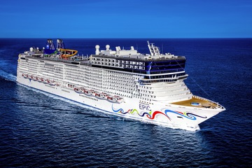
Ready to break away from your everyday routine? As one of our larger ships, Norwegian Breakaway® offers everything you need to feel a world away whilst cruising to top destinations. Take a Caribbean cruise and swim with dolphins, step back into history on a Mediterranean Cruise, or just enjoy relaxing days on a Transatlantic voyage. Enjoy some much deserved “me time” at the award-winning Mandara Spa® and the Thermal Suite. Or kick things up a notch at the Sports Complex with the multi-level, challenging ropes course and splash into good times at the Aqua Park. 

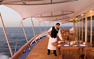
Hoping to take your tastebuds on a delicious globe-trotting journey? Savour authentic Brazilian cuisine at Moderno Churrascaria, elegant French fare at Le Bistro, the finest ingredients at our vibrant Italian ristorante La Cucina and so much more. Dine oceanside and beneath the stars along the quarter-mile long promenade, The Waterfront, and toast incredible ocean sunsets at one of our unique bars and lounges. Then get ready for amazing nights at sea with vibrant original productions and live music.

Cruise ID: 40127

Skyy® Vodka Ice Bar
Now this is as cool as it gets. Inspired by the original ice hotels in Scandinavia, the Skyy Vodka Ice Bar is a unique arctic-like frozen chamber where the bar, seating and glasses are made entirely from ice. The bar is kept at 17 degrees Fahrenheit and features speciality drinks made from Skyy Vodka, guaranteed to give guests the ultimate chill.

Guests should not feel obliged to offer a gratuity for good service. However, all of our staff are encouraged to "go the extra mile", and so they are permitted to accept cash gratuities entirely at the discretion of our guests who wish to acknowledge particular staff members for exceptional or outstanding service. In other words, there is genuinely no need to tip but you should feel free to do so if you have a desire to acknowledge particular individuals.

Date Time Price * Booking
15 November 2026 16:00 €973 Call us to book
06 December 2026 16:00 €973 Call us to book
20 December 2026 16:00 €1,448 Call us to book
03 January 2027 16:00 €1,072 Call us to book
17 January 2027 16:00 €1,022 Call us to book
31 January 2027 16:00 €1,022 Call us to book
14 February 2027 16:00 €1,072 Call us to book
07 March 2027 16:00 €1,115 Call us to book
14 March 2027 16:00 €1,115 Call us to book
28 March 2027 16:00 €1,173 Call us to book

* Price based on lowest available cruise only fare for double occupancy. Subject to change at any time.

Cabins on Norwegian Breakaway

Oceanview with Picture Window
2-5

Enjoy a large picture window and two lower beds that convert to a queen-size bed.

Facilities

  • Queen or Twin Configuration
  • Shower
  • Room Service Available
  • TV
  • Safe
  • Telephone
  • Desk
  • Toiletries Provided
  • Wi-Fi (Additional Cost)
  • Hair Dryer

Solo Oceanview
1

These staterooms feature a large round window and a queen-size bed. Staterooms are priced exclusively for solo travelers and include access to the private Studio Lounge.

Facilities

  • Queen or Twin Configuration
  • Shower
  • Toiletries Provided
  • Room Service Available
  • TV
  • Safe
  • Hair Dryer
  • Telephone
  • Desk

Sail Away Balcony
1-4

A Sail Away Balcony stateroom guarantees a Balcony stateroom or better! Please note that the view from your balcony may be fully obstructed or partially obstructed. Your stateroom may be on any deck and assigned up to one day prior to embarkation.

Facilities

  • Queen or Twin Configuration
  • Room Service Available
  • TV
  • Safe
  • Hair Dryer
  • Telephone
  • Desk
  • Lounge Area
  • Shower
  • Toiletries Provided
  • Wi-Fi (Additional Cost)

Solo Balcony
1

These spacious staterooms include a queen-size bed, sitting area and floor-to-ceiling glass doors that open onto a private balcony. Staterooms are priced exclusively for solo travelers and include access to the private Studio Lounge.

Facilities

  • Bath
  • Queen or Twin Configuration
  • Lounge Area
  • Shower
  • Toiletries Provided
  • Room Service Available
  • TV
  • Coffee Machine
  • Safe
  • Hair Dryer
  • Telephone
  • Desk

Family Oceanview
4-5

Perfect for families, these staterooms include two lower beds that convert to a queen-size bed, a bathtub in select rooms and additional bedding for up to 3. Accommodates up to five guests.

Facilities

  • Queen or Twin Configuration
  • Shower
  • Room Service Available
  • TV
  • Safe
  • Telephone
  • Desk
  • Bath
  • Lounge Area
  • Toiletries Provided
  • Wi-Fi (Additional Cost)
  • Hair Dryer

The Haven Penthouse Suite with Balcony
1-2

Total pampering awaits with features like a private balcony, king-size bed, jacuzzi, soothing décor and a sitting area with a vanity. This Penthouse suite is located near the front of the ship and includes access to The Haven and all its premium amenities.

Facilities

  • Bath
  • King or Twin Configuration
  • Sofa Bed
  • Lounge Area
  • Dining Area
  • Shower
  • Toiletries Provided
  • Room Service Available
  • Suite Benefits
  • TV
  • Wi-Fi (Additional Cost)
  • Safe
  • Hair Dryer
  • Telephone
  • Desk

Family Club Balcony Suite
1-4

Family and friends, up to four total, will be comfortable with the extra space this Club Balcony Suite provides. Located on the upper decks, midship or forward, it includes two lower beds that can convert to a queen, sleeper sofa, a sitting area and one bathroom/shower, some with a bathtub. Some can connect to a Club Balcony Suite or Balcony Stateroom so you can spread out yet stay close together.

Facilities

  • Queen or Twin Configuration
  • Sofa Bed
  • Lounge Area
  • Shower
  • Room Service Available
  • TV
  • Safe
  • Hair Dryer
  • Telephone
  • Desk
  • Toiletries Provided
  • Wi-Fi (Additional Cost)

Balcony
2-4

Take in the amazing views from these staterooms that include two lower beds that convert to a queen-size bed and additional bedding that can accommodate two guests. Some can connect to other staterooms, so you can enjoy your privacy yet stay close to friends or family.

Facilities

  • Queen or Twin Configuration
  • Shower
  • Room Service Available
  • TV
  • Safe
  • Telephone
  • Desk
  • Lounge Area
  • Toiletries Provided
  • Wi-Fi (Additional Cost)
  • Hair Dryer

The Haven Deluxe Owner's Suite with Large Balcony
1-4

Located in The Haven, these Suites offer amazing ocean views, a living and dining area with wet bar and an extra-spacious wraparound balcony. They include a king-size bed that faces floor-to-ceiling windows, luxury bath, separate shower and two modern vanity sinks. Large wardrobe and dressing area with full closet, double sofa and guest half bathroom. Can connect to The Haven Courtyard Penthouse with Balcony.

Facilities

  • King or Twin Configuration
  • Sofa Bed
  • Lounge Area
  • Dining Area
  • Shower
  • Bath
  • Room Service Available
  • TV
  • Safe
  • Hair Dryer
  • Telephone
  • Desk
  • Exclusive
  • Toiletries Provided
  • Suite Benefits
  • Wi-Fi (Additional Cost)

The Haven Aft-Facing Penthouse with Master Bedroom and Balcony
1-4

Comfort and luxury abound in this aft-facing, spacious Penthouse with a balcony that provides incredible views from the back of the ship. Features include a king size bed, luxury bath with bathtub and separate shower, living area, dining area and a guest bathroom with shower. Best of all, it's located in The Haven where you'll enjoy premium amenities including exclusive key card access to the Courtyard area, restaurant, lounge and 24-hour butler and concierge service. Some can connect to a Balcony Stateroom for even more room to spread out yet stay together.

Facilities

  • King or Twin Configuration
  • Lounge Area
  • Dining Area
  • Shower
  • Bath
  • Room Service Available
  • Butler Service
  • TV
  • Safe
  • Hair Dryer
  • Telephone
  • Desk
  • Exclusive
  • Toiletries Provided
  • Suite Benefits
  • Wi-Fi (Additional Cost)

The Haven Deluxe Owner's Suite with Balcony
1-4

Marvel at the captain's view of the ocean in your private and luxurious Owner's Suite located in The Haven. This suite has a separate living and dining area with floor-to-ceiling views and 24-hour butler and concierge service. King-size bed with a luxury bath containing a bath tub and separate shower. Additional bedding that accommodates two and guest bathroom.

Facilities

  • Lounge Area
  • Dining Area
  • Shower
  • Room Service Available
  • Butler Service
  • TV
  • Safe
  • Hair Dryer
  • Telephone
  • Desk
  • Exclusive
  • Bath
  • King or Twin Configuration
  • Toiletries Provided
  • Suite Benefits
  • Wi-Fi (Additional Cost)

The Haven 2-Bedroom Family Villa with Balcony
5-6

Perfect for the families, these suites offer plenty of space and privacy. The master bedroom has a king-size bed and a luxury bath with bathtub and separate shower. The second bedroom has a single sofa bed and bathroom with shower. Living and dining area with additional bedding to accommodate up to two guests. Experience amazing views from your private balcony.

Facilities

  • King or Twin Configuration
  • Sofa Bed
  • Lounge Area
  • Dining Area
  • Shower
  • Bath
  • Room Service Available
  • TV
  • Safe
  • Hair Dryer
  • Telephone
  • Desk
  • Exclusive
  • Second Bedroom
  • Toiletries Provided
  • Suite Benefits
  • Wi-Fi (Additional Cost)

The Haven Aft-Facing Penthouse with Master Bedroom & Large Balcony
1-4

Located in the aft corners of decks 9 and 12, these Penthouse suites offer unforgettable views with floor to ceiling windows and extra large balconies. Indulge in the premium amenities of The Haven, with exclusive key card access to the Courtyard area, restaurant, lounge, 24-hour butler and concierge service. Featuring a king size bed, luxury bath with bathtub and separate shower, living area with double sofa bed, dining area and guest bathroom. Can connect to a Balcony Stateroom so you can spread out yet stay together.

Facilities

  • King or Twin Configuration
  • Sofa Bed
  • Lounge Area
  • Dining Area
  • Shower
  • Room Service Available
  • Butler Service
  • TV
  • Safe
  • Hair Dryer
  • Telephone
  • Desk
  • Exclusive
  • Bath
  • Toiletries Provided
  • Suite Benefits
  • Wi-Fi (Additional Cost)

Club Balcony Suite with Larger Balcony
3-4

Featuring two beds that convert to a queen, extra bedding for two and a large, private balcony these Club Balcony Suites also offer amazing views. Enjoy the dining and excitement just steps away from The Waterfront.

Facilities

  • Queen or Twin Configuration
  • Shower
  • Room Service Available
  • TV
  • Safe
  • Telephone
  • Desk
  • Lounge Area
  • Toiletries Provided
  • Wi-Fi (Additional Cost)
  • Hair Dryer

The Haven Courtyard Penthouse with Balcony
2-3

With exclusive key card access to The Haven and all its premium amenities, these Penthouses provide comfort and luxury with access to the secluded Courtyard Area, private restaurant and lounge. Featuring a king size bed, bath tub with shower (except in wheelchair accessible staterooms) and floor-to-ceiling glass doors that open to your private balcony. Two of these Penthouses can connect to The Haven Deluxe Owner's Suite with Large Balcony.

Facilities

  • King or Twin Configuration
  • Shower
  • Room Service Available
  • TV
  • Safe
  • Hair Dryer
  • Telephone
  • Desk
  • Exclusive
  • Bath
  • Lounge Area
  • Dining Area
  • Toiletries Provided
  • Suite Benefits
  • Wi-Fi (Additional Cost)

The Haven Forward-Facing Penthouse with Balcony
3-4

Get a bird's-eye view of the amazing vistas ahead from the serenity of your private balcony. Desirably located forward on the corners of decks 9-13, these Penthouses have exclusive key card access to The Haven Courtyard area, restaurant and lounge and 24-hour butler and concierge service. Featuring a king size bed, luxury bath with bathtub and separate shower, living area with single sofa bed and dining area. Some can connect to a Balcony Stateroom for even more space.

Facilities

  • King or Twin Configuration
  • Shower
  • Room Service Available
  • TV
  • Safe
  • Hair Dryer
  • Telephone
  • Desk
  • Exclusive
  • Bath
  • Sofa Bed
  • Lounge Area
  • Dining Area
  • Toiletries Provided
  • Suite Benefits
  • Wi-Fi (Additional Cost)

Inside
2-4

These staterooms include two lower beds that convert to a queen-size bed. Door opens to centre interior corridor for categories IA, IC & IF.

Facilities

  • Queen or Twin Configuration
  • Shower
  • Room Service Available
  • TV
  • Safe
  • Telephone
  • Desk
  • Toiletries Provided
  • Wi-Fi (Additional Cost)
  • Hair Dryer

Spa Club Balcony Suite
1-3

These Club Balcony Suites feature tranquil spa décor and includes two beds that convert to a queen, extra bedding for additional guest(s), oversized waterfall shower and multiple body spray jets, easy access to the adjacent Mandara Spa and fitness centre, as well as complimentary access to the Thermal Suite during regular Spa hours.

Facilities

  • Queen or Twin Configuration
  • Shower
  • Room Service Available
  • TV
  • Safe
  • Telephone
  • Desk
  • Lounge Area
  • Toiletries Provided
  • Suite Benefits
  • Wi-Fi (Additional Cost)
  • Hair Dryer

Sail Away Club Balcony Suite
1-3

A Sail Away Club Balcony Suite stateroom guarantees a Club Balcony Suite stateroom or better! Please note that the view from your balcony may be fully obstructed or partially obstructed. Your stateroom may be on any deck and assigned up to one day prior to embarkation.

Facilities

  • Queen or Twin Configuration
  • Room Service Available
  • TV
  • Safe
  • Hair Dryer
  • Telephone
  • Desk
  • Bath
  • Lounge Area
  • Shower
  • Toiletries Provided
  • Wi-Fi (Additional Cost)

Sail Away Inside
1-4

A Sailaway Inside stateroom guarantees an Inside stateroom or better! Your stateroom may be on any deck and assigned between time of booking up to one day prior to embarkation.

Facilities

  • Queen or Twin Configuration
  • Shower
  • Room Service Available
  • TV
  • Safe
  • Telephone
  • Desk
  • Toiletries Provided
  • Wi-Fi (Additional Cost)
  • Hair Dryer

Family Balcony
1-4

Ideal for the whole family, these staterooms are conveniently located near the kids' area and include two lower beds that convert to a queen-size bed, an upper bed and a sofa bed. Many can connect to other staterooms, so you have the option to spread out yet stay together.

Facilities

  • Queen or Twin Configuration
  • Sofa Bed
  • Room Service Available
  • Safe
  • Hair Dryer
  • Telephone
  • Desk
  • Pullman Bed
  • Lounge Area
  • Shower
  • Toiletries Provided
  • TV
  • Wi-Fi (Additional Cost)

Family Inside
1-4

An affordable family option and conveniently located near our kids' area, these staterooms include two lower beds that convert to a queen-size bed and two pull-down beds. Some can connect to other staterooms, giving you even more room to spread out. (Door opens to centre interior corridor.)

Facilities

  • Queen or Twin Configuration
  • Pullman Bed x2
  • Shower
  • Room Service Available
  • TV
  • Safe
  • Telephone
  • Desk
  • Toiletries Provided
  • Wi-Fi (Additional Cost)
  • Hair Dryer

Studios
1

Specifically designed and priced for solo travellers, our Studios feature a full-size bed, separate bath area and access to the private Studio Lounge - no single supplement required.

Private keycard access complex comprised of staterooms specifically designed and priced for the solo traveller. Featuring a full-size bed, a one-way window to the corridor, and separate areas for your bathroom, sink and shower, in 100 square feet of living space. Includes access to the private Studio Lounge. Plus, some Studios can connect to each other so you can stay close yet still enjoy your privacy. No single supplement required.

Facilities

  • Queen or Twin Configuration
  • Shower
  • Room Service Available
  • TV
  • Safe
  • Hair Dryer
  • Telephone
  • Desk
  • Lounge Area
  • Toiletries Provided
  • Wi-Fi (Additional Cost)

Solo Inside
1

These staterooms include a queen-size bed and the same amenities as other inside staterooms. Staterooms are priced exclusively for solo travelers and include access to the private Studio Lounge.

Facilities

  • Queen or Twin Configuration
  • Shower
  • Toiletries Provided
  • Room Service Available
  • TV
  • Wi-Fi (Additional Cost)
  • Safe
  • Hair Dryer
  • Desk

Sail Away Oceanview
1-2

A Sail Away Oceanview stateroom guarantees an Oceanview stateroom or better! Please note that the view may be fully obstructed, partially obstructed, porthole or picture window. Your stateroom may be on any deck and assigned up to one day prior to embarkation.

Facilities

  • Queen or Twin Configuration
  • Room Service Available
  • TV
  • Safe
  • Hair Dryer
  • Telephone
  • Desk
  • Shower
  • Toiletries Provided
  • Wi-Fi (Additional Cost)

Aft-Facing Club Balcony Suite
1-2

These Club Balcony Suites have plenty of room for you to spread out with two beds that convert to a queen and a large aft-facing balcony to take in the amazing views.

Facilities

  • Queen or Twin Configuration
  • Shower
  • Room Service Available
  • TV
  • Safe
  • Hair Dryer
  • Telephone
  • Desk
  • Lounge Area
  • Toiletries Provided
  • Wi-Fi (Additional Cost)

Aft-Facing Balcony
2-3

These staterooms include two lower beds that convert to a queen-size bed and are aft-facing, so the view from your private balcony is amazing.

Facilities

  • Queen or Twin Configuration
  • Shower
  • Room Service Available
  • TV
  • Hair Dryer
  • Telephone
  • Desk
  • Lounge Area
  • Toiletries Provided
  • Wi-Fi (Additional Cost)
  • Safe

Club Balcony Suite
2-4

Up to four guests can enjoy the extra space this Club Balcony Suite provides. Located mid-ship or forward, it includes two lower beds that can convert to a queen, foldable sleeper, and one bathroom with shower, some with a bathtub.

Facilities

  • Queen or Twin Configuration
  • Shower
  • Bath
  • Room Service Available
  • Safe
  • Hair Dryer
  • Telephone
  • Desk
  • Lounge Area
  • Toiletries Provided
  • TV
  • Wi-Fi (Additional Cost)

Large Balcony
2-4

These staterooms have a large balcony offering incredible views, two lower beds that convert to a queen-size bed and additional bedding to sleep one or two more.

Facilities

  • Queen or Twin Configuration
  • Room Service Available
  • TV
  • Safe
  • Hair Dryer
  • Telephone
  • Desk
  • Lounge Area
  • Shower
  • Toiletries Provided
  • Wi-Fi (Additional Cost)

View Itinerary By Date


Day 1 San Juan (Puerto Rico), Puerto Rico

If you associate Puerto Rico's capital with the colonial streets of Old San Juan, then you know only part of the picture. San Juan is a major metropolis, radiating out from the bay on the Atlantic Ocean that was discovered by Juan Ponce de León. More than a third of the island's nearly 4 million citizens proudly call themselves sanjuaneros. The city may be rooted in the past, but it has its eye on the future. Locals go about their business surrounded by colonial architecture and towering modern structures.By 1508 the explorer Juan Ponce de León had established a colony in an area now known as Caparra, southeast of present-day San Juan. He later moved the settlement north to a more hospitable peninsular location. In 1521, after he became the first colonial governor, Ponce de León switched the name of the island—which was then called San Juan Bautista in honor of St. John the Baptist—with that of the settlement of Puerto Rico ("rich port").Defended by the imposing Castillo San Felipe del Morro (El Morro) and Castillo San Cristóbal, Puerto Rico's administrative and population center remained firmly in Spain's hands until 1898, when it came under U.S. control after the Spanish-American War. Centuries of Spanish rule left an indelible imprint on the city, particularly in the walled area now known as Old San Juan. The area is filled with cobblestone streets and brightly painted, colonial-era structures, and its fortifications have been designated a UNESCO World Heritage Site.Old San Juan is a monument to the past, but most of the rest of the city is planted firmly in the 21st century and draws migrants island-wide and from farther afield to jobs in its businesses and industries. The city captivates residents and visitors alike with its vibrant lifestyle as well as its balmy beaches, pulsing nightclubs, globe-spanning restaurants, and world-class museums. Once you set foot in this city, you may never want to leave.

Day 2 La Romana, Dominican Republic

Neither pretty nor quaint, La Romana has a central park, an interesting market, a couple of good restaurants, banks and small businesses, a public beach, and Jumbo, a major supermarket. If you are staying for a week or more you may want to buy a Dominican cell phone at Jumbo. It's a mere $20 for a basic one, plus minutes. It can save you untold money if you'll be making local calls from your hotel/resort. It is, at least, a real slice of Dominican life. Casa de Campo is just outside La Romana, and other resorts are found in the vicinity of nearby Bayahibe. Although there are now more resorts in the area, this 7,000-acre luxury enclave put the town on the map. Casa de Campo Marina, with its Mediterranean design and impressive yacht club and villa complex, is as fine a marina facility as can be found anywhere; the shops and restaurants at the marina are a big draw for all tourists to the area.

Day 3 Oranjestad, Aruba

Aruba's capital is easily explored on foot. Its palm-lined central thoroughfare runs between old and new pastel-painted buildings of typical Dutch design (Spanish influence is also evident in some of the architecture). There are a lot of malls with boutiques and shops—the Renaissance mall carries high-end luxury items and designer fashions. A massive renovation in downtown has given Main Street (a.k.a. Caya G. F. Betico Croes) behind the Renaissance Resort a whole new lease on life: boutique malls, shops, and restaurants have opened next to well-loved family-run businesses. The pedestrian-only walkway and resting areas have unclogged the street, and the new eco-trolley is free and a great way to get around. At this writing, Linear Park was well and will showcase local merchants and artists. There will be activities along a boardwalk that will eventually run all the way to the end of Palm Beach, making it the longest of its kind in the Caribbean.

Day 4 Willemstad, Curaçao

Dutch settlers came here in the 1630s, about the same time they sailed through the Verazzano Narrows to Manhattan, bringing with them original red-tile roofs, first used on the trade ships as ballast and later incorporated into the architecture of Willemstad. Much of the original colonial structures remain, but this historic city is constantly reinventing itself and the government monument foundation is always busy restoring buildings in one urban neighborhood or another. The salty air causes what is called "wall cancer" which causes the ancient abodes to continually crumble over time. The city is cut in two by Santa Anna Bay. On one side is Punda (the point)—crammed with shops, restaurants, monuments, and markets and a new museum retracing its colorful history. And on the other side is Otrobanda (literally meaning the "other side"), with lots of narrow, winding streets and alleyways (called "steekjes" in Dutch), full of private homes notable for their picturesque gables and Dutch-influenced designs. In recent years the ongoing regeneration of Otrobanda has been apparent, marked by a surge in development of new hotels, restaurants, and shops; the rebirth, concentrated near the waterfront, was spearheaded by the creation of the elaborate Kura Hulanda complex.There are three ways to cross the bay: by car over the Juliana Bridge; by foot over the Queen Emma pontoon bridge (locally called "The Swinging Old Lady"); or by free ferry, which runs when the pontoon bridge is swung open for passing ships. All the major hotels outside town offer free shuttle service to town once or twice daily. Shuttles coming from the Otrobanda side leave you at Riffort. From here it's a short walk north to the foot of the pontoon bridge. Shuttles coming from the Punda side leave you near the main entrance to Ft. Amsterdam.

Day 5  Cruising

Day 6 Saint Thomas, U.S. Virgin Islands

If you fly to the 32-square-mile (83-square-km) island of St. Thomas, you land at its western end; if you arrive by cruise ship, you come into one of the world's most beautiful harbors. Either way, one of your first sights is the town of Charlotte Amalie. From the harbor you see an idyllic-looking village that spreads into the lower hills. If you were expecting a quiet hamlet with its inhabitants hanging out under palm trees, you've missed that era by about 300 years. Although other islands in the USVI developed plantation economies, St. Thomas cultivated its harbor, and it became a thriving seaport soon after it was settled by the Danish in the 1600s. The success of the naturally perfect harbor was enhanced by the fact that the Danes—who ruled St. Thomas with only a couple of short interruptions from 1666 to 1917—avoided involvement in some 100 years' worth of European wars. Denmark was the only European country with colonies in the Caribbean to stay neutral during the War of the Spanish Succession in the early 1700s. Thus, products of the Dutch, English, and French islands—sugar, cotton, and indigo—were traded through Charlotte Amalie, along with the regular shipments of slaves. When the Spanish wars ended, trade fell off, but by the end of the 1700s Europe was at war again, Denmark again remained neutral, and St. Thomas continued to prosper. Even into the 1800s, while the economies of St. Croix and St. John foundered with the market for sugarcane, St. Thomas's economy remained vigorous. This prosperity led to the development of shipyards, a well-organized banking system, and a large merchant class. In 1845 Charlotte Amalie had 101 large importing houses owned by the English, French, Germans, Haitians, Spaniards, Americans, Sephardim, and Danes. Charlotte Amalie is still one of the world's most active cruise-ship ports. On almost any day at least one and sometimes as many as eight cruise ships are tied to the docks or anchored outside the harbor. Gently rocking in the shadows of these giant floating hotels are just about every other kind of vessel imaginable: sleek sailing catamarans that will take you on a sunset cruise complete with rum punch and a Jimmy Buffett soundtrack, private megayachts for billionaires, and barnacle-bottom sloops—with laundry draped over the lifelines—that are home to world-cruising gypsies. Huge container ships pull up in Sub Base, west of the harbor, bringing in everything from breakfast cereals to tires. Anchored right along the waterfront are down-island barges that ply the waters between the Greater Antilles and the Leeward Islands, transporting goods such as refrigerators, VCRs, and disposable diapers. The waterfront road through Charlotte Amalie was once part of the harbor. Before it was filled in to build the highway, the beach came right up to the back door of the warehouses that now line the thoroughfare. Two hundred years ago those warehouses were filled with indigo, tobacco, and cotton. Today the stone buildings house silk, crystal, and diamonds. Exotic fragrances are still traded, but by island beauty queens in air-conditioned perfume palaces instead of through open market stalls. The pirates of old used St. Thomas as a base from which to raid merchant ships of every nation, though they were particularly fond of the gold- and silver-laden treasure ships heading to Spain. Pirates are still around, but today's versions use St. Thomas as a drop-off for their contraband: illegal immigrants and drugs. To explore outside Charlotte Amalie, rent a car or hire a taxi. Your rental car should come with a good map; if not, pick up the pocket-size "St. Thomas–St. John Road Map" at a tourist information center. Roads are marked with route numbers, but they're confusing and seem to switch numbers suddenly. Roads are also identified by signs bearing the St. Thomas–St. John Hotel and Tourism Association's mascot, Tommy the Starfish. More than 100 of these color-coded signs line the island's main routes. Orange signs trace the route from the airport to Red Hook, green signs identify the road from town to Magens Bay, Tommy's face on a yellow background points from Mafolie to Crown Bay through the north side, red signs lead from Smith Bay to Four Corners via Skyline Drive, and blue signs mark the route from the cruise-ship dock at Havensight to Red Hook. These color-coded routes are not marked on most visitor maps, however. Allow yourself a day to explore, especially if you want to stop to take pictures or to enjoy a light bite or refreshing swim. Most gas stations are on the island's more populated eastern end, so fill up before heading to the north side. And remember to drive on the left!

Day 7 Road Town, Tortola, British Virgin Islands

Day 8 San Juan (Puerto Rico), Puerto Rico

If you associate Puerto Rico's capital with the colonial streets of Old San Juan, then you know only part of the picture. San Juan is a major metropolis, radiating out from the bay on the Atlantic Ocean that was discovered by Juan Ponce de León. More than a third of the island's nearly 4 million citizens proudly call themselves sanjuaneros. The city may be rooted in the past, but it has its eye on the future. Locals go about their business surrounded by colonial architecture and towering modern structures.By 1508 the explorer Juan Ponce de León had established a colony in an area now known as Caparra, southeast of present-day San Juan. He later moved the settlement north to a more hospitable peninsular location. In 1521, after he became the first colonial governor, Ponce de León switched the name of the island—which was then called San Juan Bautista in honor of St. John the Baptist—with that of the settlement of Puerto Rico ("rich port").Defended by the imposing Castillo San Felipe del Morro (El Morro) and Castillo San Cristóbal, Puerto Rico's administrative and population center remained firmly in Spain's hands until 1898, when it came under U.S. control after the Spanish-American War. Centuries of Spanish rule left an indelible imprint on the city, particularly in the walled area now known as Old San Juan. The area is filled with cobblestone streets and brightly painted, colonial-era structures, and its fortifications have been designated a UNESCO World Heritage Site.Old San Juan is a monument to the past, but most of the rest of the city is planted firmly in the 21st century and draws migrants island-wide and from farther afield to jobs in its businesses and industries. The city captivates residents and visitors alike with its vibrant lifestyle as well as its balmy beaches, pulsing nightclubs, globe-spanning restaurants, and world-class museums. Once you set foot in this city, you may never want to leave.

Video provided by 3rd party and complete accuracy can not be guaranteed
Call our experts now

Dublin (01) 2311868

Cruise Finder

All the best cruise deals in one place


TRAVEL AWARE - STAYING SAFE AND HEALTHY ABROAD

The Department of Foreign Affairs has up-to-date advice for Irish citizens on staying safe and healthy abroad. For more security, local laws, health, passport and visa information see https://www.dfa.ie/travel/travel-advice/ and follow dfatravelwise